Recreation
City Parks
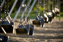
Deshler has plenty of wonderful parks to visit.
Washington Park covers 10 acres, has free camping hook-ups and picnic areas. The park also has facilities for swimming, horseshoes and sand volleyball.
Map it
Centennial Park full of a variety of perennials, trees, and arbor to enjoy the peacefulness of the country.
Map it
Bicentennial Park is located next to the public library to enjoy the small hustle of the downtown area.
Map it
Rattlesnake Run Disc Golf Course
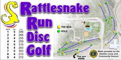
Rattlesnake Run Disc Golf Course - The course follows the creek from
the Friendship Park to the Fairgrounds, across the bridge, follows the creek
east, down behind the ball field and back again to the east side of the creek,
go north and cross the bridge north of the friendship park back to the parking
lot. The course is approximately 3/4 of a mile long.
Map it
the Friendship Park to the Fairgrounds, across the bridge, follows the creek
east, down behind the ball field and back again to the east side of the creek,
go north and cross the bridge north of the friendship park back to the parking
lot. The course is approximately 3/4 of a mile long.
Map it
City Park Walking Trail
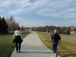
The trail head starts at the Park Bridge on the south side, the path
follows the creek, south and then east, behind the ball parks, winds around the
north side of the ball fields, then across the street up by the swimming pool
and down through the park back to the starting point. The trail is
approximately 3/4 of a mile long.
Map it
follows the creek, south and then east, behind the ball parks, winds around the
north side of the ball fields, then across the street up by the swimming pool
and down through the park back to the starting point. The trail is
approximately 3/4 of a mile long.
Map it
Deshler Parks & Recreation Board
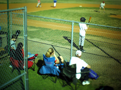
The Deshler Park and Recreation Board oversees baseball, softball, T-ball, sand volleyball and various other park activities. For more information, call (402) 365-4433.
Skyhawk Field
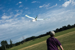
The local Deshler Skyhawk's RC Club flies their radio controlled model
aircraft and model rockets at this site. You must have AMA insurance to fly at
this field. Skyhawk Field is located at 615 West Highway 136, or 3/8 mile west
of Hwy. 136 / Hwy 5 intersection. For more information call Bob Reinke at (402)
365-4282 or email: rnreinke@gpcom.net
Map It
aircraft and model rockets at this site. You must have AMA insurance to fly at
this field. Skyhawk Field is located at 615 West Highway 136, or 3/8 mile west
of Hwy. 136 / Hwy 5 intersection. For more information call Bob Reinke at (402)
365-4282 or email: rnreinke@gpcom.net
Map It